Chain Lakes Trail – Mt. Baker Wilderness

IMG_8136

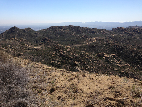
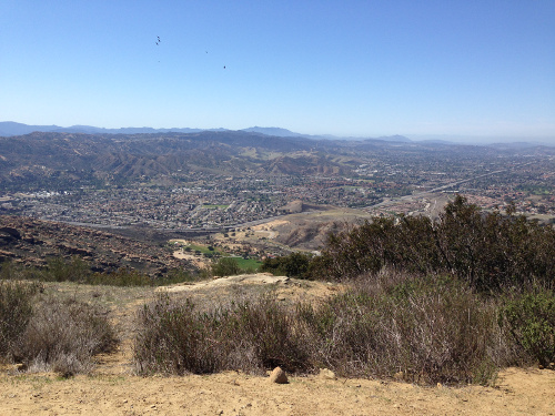
I finally have to say good-bye to summer. I dragged summer through September because I wasn’t ready to move on. Our summer was pretty lame around here. It rained a lot and never got very hot. At the end of September I visited my brother and went for the best hike I’ve ever done. Even better than the ones I took last spring, here, here, and here. First, I had a hiking buddy this time. My sister-in-law chose the hike for the two of us. A long 8 mile hike up and down through the mountains in the wilderness in black bear country. Second, the views were amazing. Something from the movies. Or a postcard. Indescribably gorgeous. And serene. And quiet. If you stopped and listened, you heard nothing! Not a car, not a TV, not a voice, not a phone. Nothing. Third, I was in much better shape. I even got adventurous and tried some running. Walking on the trails is hard enough not to twist an ankle. Running was a little scary! But fun.

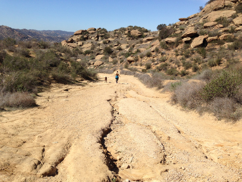
Most of the trail was single person wide. Quite a bit of it was slippery mud. The rest was rocks, ranging from gravel all the way up to boulder climbing. Being in the mountains, there were plenty of stream crossings. Most were about 1-2 ft across with 1-3 inches of flowing water. Most of the trail was decorated with wild blueberries, a little past their prime, but still very edible.

We started at about 4700 ft elevation. The air was thin and took some getting used to. We went up and down a lot. Our first peak height reached was about 5200 ft. Then back down to about 4700 ft around the lakes. Our second peak height was about 5500 ft, then down to about 4200 ft around another lake. Then back up to the car.

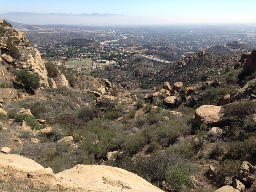
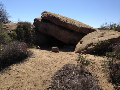
Enjoy the views with me:

Looking back on the trail that came straight across that steep slope.

Looking back on the trail that came straight across that steep slope.

IMG_8186

I ran alongside this rushing, babbling waterfalling mountain stream-river. How cool is that?

IMG_8122

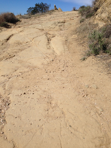
Uhoh, which way does the trail go?

IMG_8130 IMG_8125 IMG_8151 IMG_8147 IMG_8138 selfie IMG_8153 IMG_8161

Rocky Peak

Last week, while on vacation, I was able to get in another great hike up a hill/mountain, Rocky Peak. My husband had a full day of work, so I took off on my adventure while he worked. Using outdated directions, I endured a drive along a mountainside with a steep drop off to the left. This time there was no downhill, just a scary drop off. But it was not necessary as I found out the freeway I had taken actually had an exit right at the trailhead. The five parking spots at the trailhead were taken so I parked in the alternate parking on the other side of the highway. It was a bit rough for me walking across the freeway overpass back to the trailhead with my fear of heights, but it was a short walk.

Difficulty: Strenuous
Start elevation: 1,571 feet
End elevation: 2,657 feet
Distance: 5 miles round trip
Time: 2 hours 45 minutes

I read a comment on the internet to watch out for rattlesnakes. I knew this, but didn’t like being reminded. And then as I started the hike, I was greeted with this notice:

Mountain Lion Country

Mountain Lion Country

I could see I was in for an adventure. Not only did I need to watch out for rattlesnakes but also mountain lions! I really find it a lot of fun to push myself into uncomfortable territory. It’s where I can see knew things, learn new things and have awesome experiences.

The Rocky Peak trail is a fire road. I’m not sure what that means, but I would guess it’s somehow referring to the many wildfires they have. Shortly after starting out there were already great views as the internet promised. Here is a picture early on in the hike that is looking down on the freeway that I came on:

View early in the hike

View early in the hike

This path was quite a bit different than the one at Bishop Peak. There were no “steps” but a continuous, gradual incline. The ground was very uneven and rocky. But the path was wide. I did not encounter many people, so the whole hike was pretty peaceful and serene. Here are some photos of the path:

3 trail

^^ Up! Way up! ^^

4 trail

^^ Looking back down ^^

5 trail

Here’s the view about halfway up. Breathtaking:

6 halfway

The rocks were intriguing. Each one was different and they came in all different sizes and shapes. Here’s a cool-looking bunch:

7 cool rocks

Many times the view included a look back at the fire road you had hiked to get where you were. It looked so far away:

8 looking back

And here’s the amazing view from the top. At this point the fire road keeps going down the other side and along other peaks. About halfway on my way back down the trail, a woman passed me. She told me she had started out about 5 hours before me and had taken the trail “way back in”. Wow, that’s a hike!

9 top view